
Mining point clouds: processing, formats and workflows
A scanner produces points — millions a second, each a distance and an intensity from wherever the sensor was. Before they are a survey they have to be registered to each other, put on mine grid, cleaned of the things that were in the way, and written in a format the planning package reads.
The workflow is the same whether the points came from a walked heading, a flown stope or a tripod on a bench: register, georeference, clean, mesh where a surface is wanted, and export as LAS, LAZ or E57 into Vulcan, Deswik, Micromine, Surpac or Leapfrog.
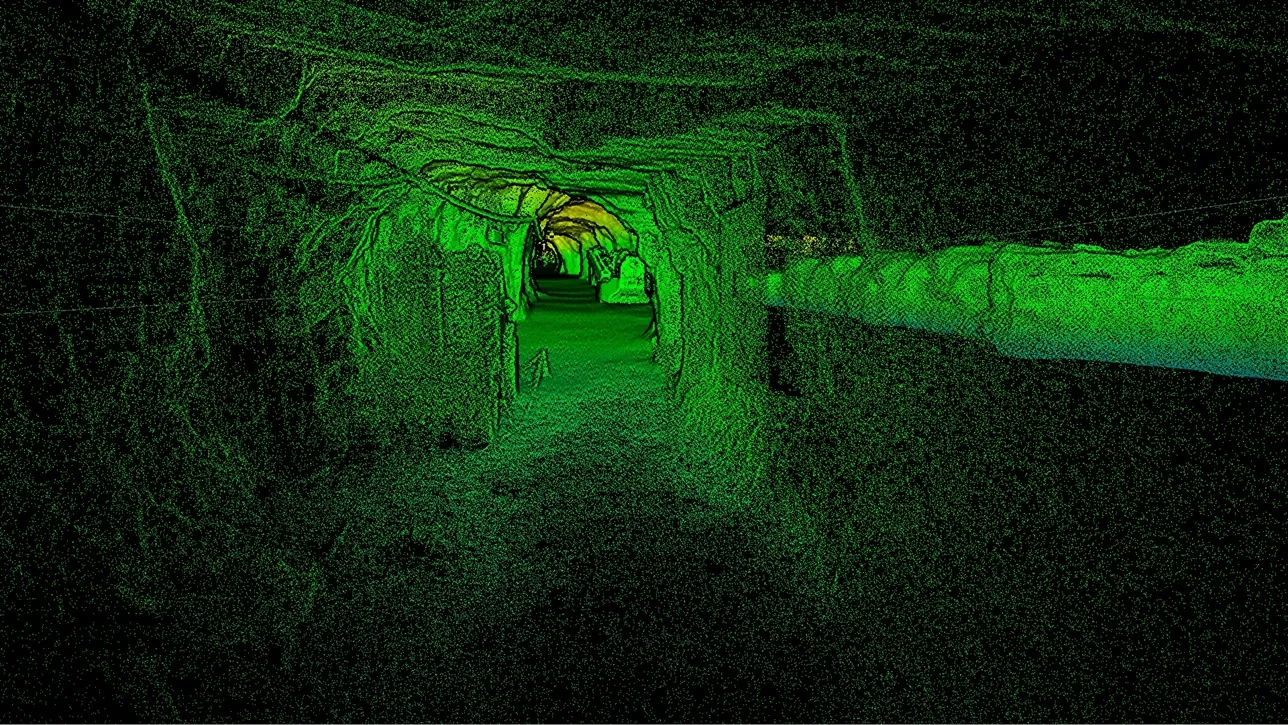
What is the point cloud workflow for mining?
Register the scans, georeference to mine grid with control and GNSS, remove noise and equipment, mesh where needed, and export LAS, LAZ or E57 to the plan.
 RegistrationTripod stations, walked trajectories and flights aligned into one cloud.
 GeoreferencingControl and GNSS put the cloud on mine grid, not on the scanner’s.
 Cleaning and meshingVehicles, people and dust removed; surfaces meshed for volumes and sections.
 LAS, LAZ, E57Open formats the mining packages read; nothing proprietary in the chain.
The sequence, and where it goes wrong
Registration comes first: every scan is in its own coordinate frame until it is aligned to the others. Tripod stations are matched on overlapping geometry or targets; a SLAM trajectory is already internally consistent and is aligned as a whole; a drone flight the same. The registration error is recorded, because it bounds everything downstream — a volume computed across a bad join is wrong by the join. Georeferencing follows: the registered cloud is transformed onto mine grid using survey control underground and GNSS on surface, and the residuals at the control points are the check that it worked.
Cleaning is where a mining cloud differs from an architectural one. Vehicles, people, dust, water spray and moving equipment were all in the scan; a stockpile with a loader in it has the loader’s volume in the pile until it is removed. Vegetation on a dump top, ventilation bag in a drive, the survey crew’s own vehicle — each is classified and removed so the surface that remains is the ground. Then, where a surface rather than points is wanted — a volume, a section, a comparison with design — the cloud is meshed, and the mesh is closed where a solid is needed.
Export is the step that decides whether any of it is useful. Artec Twins writes LAS and LAZ, the formats the mining packages expect, with intensity and classification; E57 where a package prefers it; and standard meshes for CAD and design software. Maptek Vulcan, Deswik, Micromine, GEOVIA Surpac and Leapfrog read them directly, so the point cloud arrives in the package the mine already plans in rather than in a viewer nobody else uses.
Register, georeference, clean, mesh, export
In Artec Twins, in this order; each step checked before the next.
- 1. RegisterStations, trajectories and flights aligned on shared geometry; the registration error recorded with the project.
- 2. GeoreferenceTransformed onto mine grid with survey control and GNSS; residuals at the control points checked.
- 3. CleanVehicles, people, dust, vegetation and equipment classified and removed; the ground and the rock remain.
 4. Mesh where neededSurfaces for volumes, sections and design comparison; closed solids for stopes and voids.
- 5. ExportLAS or LAZ with intensity and classification, E57, and meshes — into Vulcan, Deswik, Micromine, Surpac or Leapfrog.
Which scanner for this work
The workflow is the same for every scanner; what differs is what each contributes to the cloud.
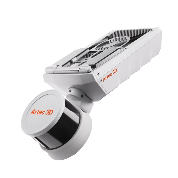
Artec Jet
- Best for
- Walked, driven and flown captures — SLAM trajectories registered as a whole
- Type
- Multi-modal SLAM LiDAR
- Accuracy, up to
- ±10 mm underground, ±15 mm general
- Change detection
- ±5 mm
- Range
- 0.5–300 m
- Positional drift
- ±0.03%
- Deployment
- Handheld, backpack, pole, drone, vehicle, cage, robot
A Jet capture arrives already internally consistent, with ±0.03% drift over the trajectory, and is registered to control as a whole. Its triple-return LiDAR helps the cleaning step: dust and mesh return separately from the rock behind them.
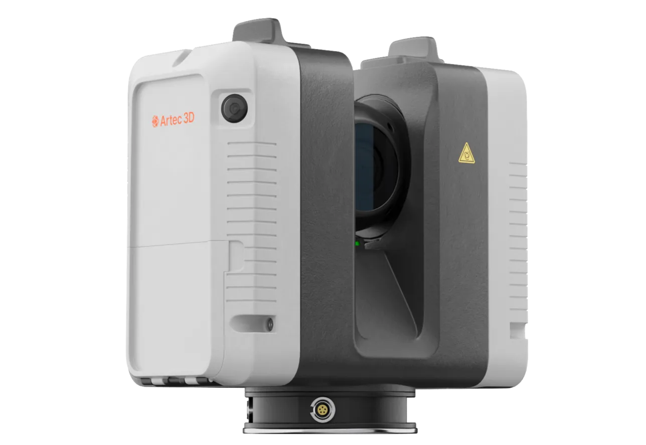
Artec Ray II
- Best for
- Tripod stations — the survey-grade surfaces the rest registers against
- Type
- Stationary long-range laser, tripod mounted
- Accuracy, up to
- 1.9 mm at 10 m, 2.9 mm at 20 m, 5.3 mm at 40 m
- Range noise
- 0.4 mm at 10 m
- Range
- 0.5–130 m
- Scan time
- 1 min 42 s at 3 mm, 10 m, without texture
- Field of view
- 360° × 300°
Ray II stations at 1.9 mm at 10 m are registered on overlapping geometry or targets and become the reference surfaces in a mixed project. Their 0.4 mm range noise at 10 m is what makes a clean mesh of a wall or a stockpile possible.
See a walked heading, a flown stope and a tripod wall registered, georeferenced and exported as LAS into your planning package in one session — book a demo for your survey data team.
Book a demoQuestions survey data managers ask
LAS or LAZ or E57 — which should we use?
LAS is the mining standard; LAZ is the same data compressed, usually a fifth of the size, and every mining package reads it. E57 carries structured scans with images and is preferred by some CAD and inspection tools. Twins writes all three.
How large are the files?
Millions of points per station or per minute of walking, so gigabytes per survey. LAZ compression and decimation to the density a job needs — full resolution on a wall, coarser on a haul road — keep working files manageable; 4C reduced a 50 GB equipment capture to a 300 MB model.
How do we know the registration is good?
The registration error and the residuals at control points are recorded with the project and exported with the data. A volume or a change map is only as good as those numbers, so they travel with it.
Do we need Artec software, or can we do this in our package?
Artec Twins does the registration, georeferencing, cleaning and export; the mining package receives finished LAS, LAZ or E57. Vulcan, Deswik, Micromine, Surpac and Leapfrog then do what they do — volumes, reconciliation, design — on data that is already on grid and clean.
Related applications
Tell us about your current point cloud workflow
Describe the packages you run, the formats you use and where the data gets stuck. A mining specialist will come back with how the workflow would run from capture to your package.