
3D measuring and surveying with a laser scanner
Conventional measurement records the dimensions someone decided to take: a distance, a level, a set of coordinates. A laser scanner records the surface — every dimension that could be taken from it, whether or not anyone thought to — and the measuring happens afterwards, on the model.
This page is the general case: what is captured, how accurately at what distance, how a large site differs from a component, and which scanner does which. The mining applications are linked from it.
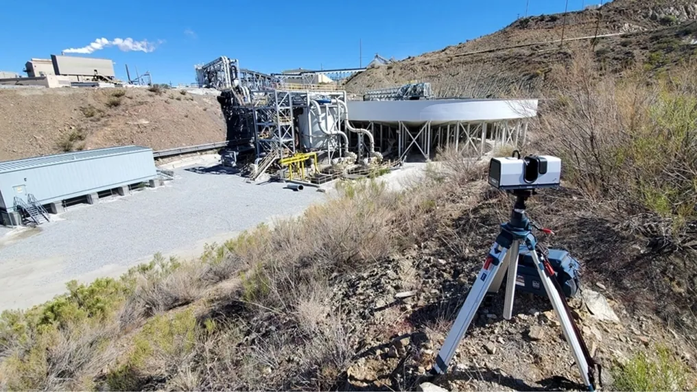
What does 3D measuring with a laser scanner mean?
The scanner records the surface as millions of measured points, so every distance, volume and section is taken from the model afterwards, at a stated range.
 The surface, not a sampleMillions of points a second across everything in view.
 Accuracy with a range1.9 mm at 10 m from a tripod; 0.1 mm at 0.35–1.2 m by hand. The distance is part of the figure.
 Measured afterwardsAny dimension, taken from the model, months later if needed.
 Without touchingFrom a tripod at 130 m or a hand at arm’s length; nothing is contacted.
How it works, and what the figures mean
A laser scanner sends out a pulse of light, times its return and computes the distance; it does this hundreds of thousands to millions of times a second while sweeping across everything in view. Each return is a point with a position relative to the scanner and an intensity. Together the points are a point cloud — the surface of whatever was in front of the instrument, as measured geometry. On a tripod the scanner stays still and every point is measured from one known position; on the move it has to know where it was for every point, which is what SLAM and GNSS provide. Measuring is then done on the cloud: a distance between two points, an area, a volume against a base, a section through a wall, a comparison with a design.
Accuracy is always a figure at a distance. Artec Ray II is 1.9 mm at 10 m, 2.9 mm at 20 m and 5.3 mm at 40 m: the error grows with range because the beam spreads and the angular error projects further. A handheld structured-light scanner such as Artec Leo works at 0.35–1.2 m and reaches 0.1 mm, because the range is short. A moving SLAM scanner such as Artec Jet is ±10 mm underground and ±15 mm on surface, because its accuracy includes knowing where it was. None of these figures means anything without its range, and a specification that gives one without the other is not a specification.
A large site and a component are therefore different jobs. A pit wall, a plant floor or a stockpile is measured from a distance at millimetres — the site is the object, and the question is its geometry at scale. A liner, a mantle or a bracket is measured at arm’s length at a tenth of a millimetre — the part is the object, and the question is whether it fits. A conventional survey answers either with the points someone chose to take; a scanner answers with the whole surface, and the choosing happens afterwards, on the model, as many times as the question comes up.
From site to measured model
The same five steps whether the object is a pit or a part.
- 1. CaptureFrom a tripod for a site, by hand for a component, on the move for a drive or a road — the scanner records the surface.
 2. RegisterMultiple captures aligned into one model on shared geometry; the registration error recorded.
 3. ReferenceA site onto mine grid with control and GNSS; a component onto its CAD datum.
 4. MeasureDistances, areas, volumes, sections and deviations from design, taken from the model.
 5. DeliverLAS, LAZ or E57 to a planning package; meshes to CAD; reports to whoever asked the question.
Which scanner for this work
Three scanners, three ranges: which one measures your object is decided by how far away it is and how fine the detail that matters.
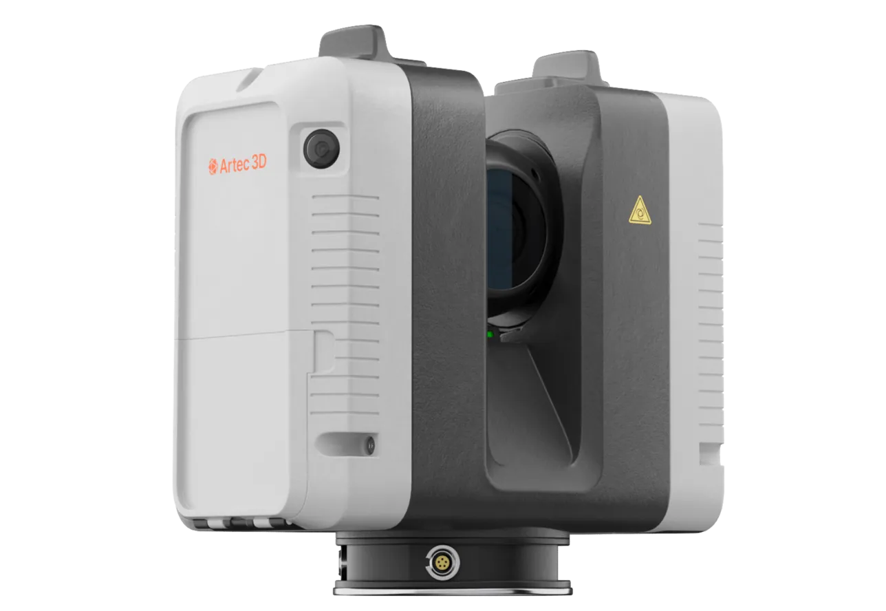
Artec Ray II
- Best for
- Sites and structures from a tripod — the whole object at survey-grade
- Type
- Stationary long-range laser, tripod mounted
- Accuracy, up to
- 1.9 mm at 10 m, 2.9 mm at 20 m, 5.3 mm at 40 m
- Range
- 0.5–130 m
- Scan time
- 1 min 42 s per station at 3 mm, 10 m
Ray II measures from 0.5 m to 130 m at 1.9 mm at 10 m, recording a full 360° × 300° station in under two minutes. It is the scanner for anything measured from a distance: walls, floors, stockpiles, plant, whole machines.
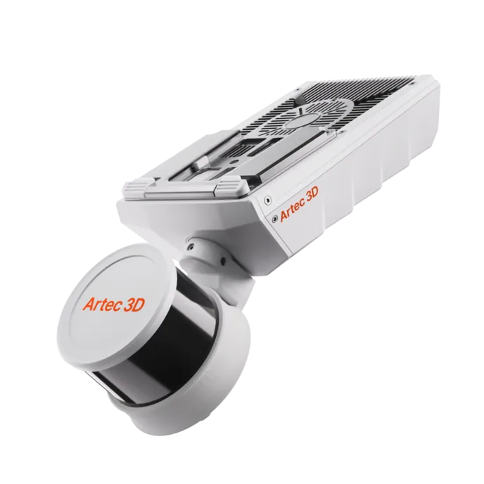
Artec Jet
- Best for
- Drives, roads and voids on the move — coverage where a tripod cannot go
- Type
- Multi-modal SLAM LiDAR
- Accuracy, up to
- ±10 mm underground, ±15 mm general
- Range
- 0.5–300 m
- Deployment
- Handheld, backpack, pole, drone, vehicle, cage, robot
Jet measures while carried, driven or flown, positioning itself by SLAM at ±0.03% drift, at ±10 mm underground and ±15 mm on surface. It is the scanner for anything that has to be measured at walking or driving pace, or from inside a space nobody can enter.
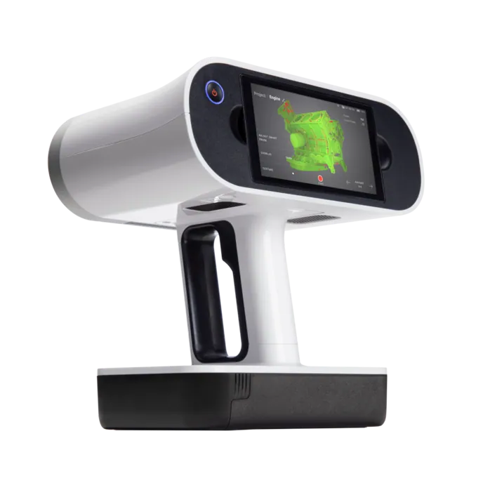
Artec Leo
- Best for
- Components and parts at arm’s length — the detail that decides a fit
- Type
- Wireless handheld structured light, all-in-one
- 3D point accuracy, up to
- 0.1 mm
- 3D resolution, up to
- 0.2 mm
- Working distance
- 0.35–1.2 m
- Capture speed
- Up to 35,000,000 points/s in HD Mode
- Onboard
- 5.5″ touchscreen, processing and 512 GB — no laptop
Leo measures at 0.35–1.2 m with 0.1 mm accuracy and colour texture, handheld and wireless with its screen and processing onboard. It is the scanner for anything whose geometry is the asset: liners, wear parts, mounting points, anything that has to be made again.
See a wall measured from 40 m and a worn part measured at arm’s length in the same afternoon, with every dimension taken from the model afterwards — book a demo for your engineering team.
Book a demoQuestions surveyors ask
How accurate is a laser scanner?
At a stated distance: Ray II is 1.9 mm at 10 m and 5.3 mm at 40 m; Leo is 0.1 mm at 0.35–1.2 m; Jet is ±10 mm underground on the move. Ask any scanner’s accuracy figure what range it was measured at.
What is a point cloud?
The scanner’s output: millions of measured points, each with a position and an intensity, that together form the surface of whatever was scanned. Distances, volumes and sections are measured on it; a mesh is made from it where a surface is needed.
How does it compare with a total station or a tape?
Those measure the points someone chose, very accurately, one at a time. The scanner measures the whole surface, so the point nobody chose is still there to be measured later. The comparison pages on this site take that further.
Which scanner do I need?
It is decided by two things: how far away the object is, and how fine the detail that matters. A site from a distance is Ray II; a drive, a road or a void on the move is Jet; a component at arm’s length is Leo. Most operations run two of the three.
Related applications
Tell us what you need to measure
Describe the object, its size and how it is measured today. A mining specialist will come back with which scanner fits, the accuracy you would get at that range and how the data reaches the people who need it.