
Drone LiDAR for mining
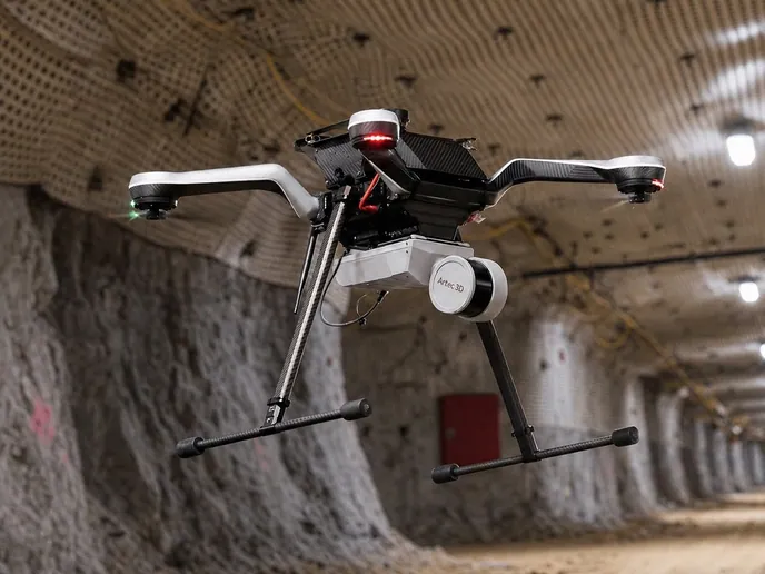
A drone takes the scanner where nothing else can: into a stope from the drawpoint, down a shaft, through the opening into a sealed level, or over a pit too large to drive in a shift. Underground there is no GPS to fly by and no light to see by, which is why the drone that carries the scanner has to fly by the scanner.
Artec Jet on a drone plans its own flight path from what it is scanning, avoids obstacles as fine as 2 mm wires, and returns the void, the shaft or the pit as a measured surface at ±10 mm underground and ±15 mm on surface.
How does drone LiDAR work underground with no GPS?
The drone flies by the scanner: SLAM positions it from the geometry, it avoids obstacles as fine as 2 mm wires in the dark, and returns the void at ±10 mm.
 Into the voidStopes, shafts, ore passes, raises and old workings, from outside them.
 Flies by the scanNo GPS, no light, no pilot line of sight: SLAM positions the drone from the rock.
 Obstacle-awarePlans its own route and avoids hanging wires as fine as 2 mm.
 Over the pit tooDumps, pits and tailings covered from the air at ±15 mm on surface.
Why an underground drone cannot be an ordinary drone
A surface drone flies by GNSS and is watched by its pilot; take away both and it has nothing to hold position with. Underground there is no satellite signal, no light for a camera to navigate by and, once the drone is inside a stope, no line of sight for the pilot. An aircraft that depends on any of those is grounded at the brow. Most of what a mine would want a drone for — the stope, the shaft, the ore pass, the old level — is exactly where all three are absent.
The alternative to flying has been not measuring. A stope is reconciled from a boom at the drawpoint, a shaft is inspected from the cage, an old level is left on the plan it was drawn on. Each is a partial measurement of a shape that current mining has to keep a stand-off from, and the stand-off is ore or safety.
A drone that flies by its scanner has what it needs. Artec Jet on a drone positions the aircraft by SLAM against the geometry it is recording, holding ±0.03% drift; it plans its own flight path through the void, avoids obstacles as fine as 2 mm wires — bag ties, blasting cable — and records everything in a 360° × 290° view at up to 1.9 million points a second, in complete darkness. On surface the same scanner flies pits, dumps and tailings at ±15 mm. Either way, the void or the ground comes back as a measured surface that Artec Twins closes, georeferences and exports as LAS, LAZ or E57.
From the brow to a measured void
The pilot launches and recovers; the drone flies the void itself.
 1. Launch from safe groundFrom the drawpoint, the shaft collar or the pit rim; nobody crosses the brow.
- 2. Fly by the scanJet plans its own path through the opening, positioning by SLAM and avoiding obstacles down to 2 mm wires.
 3. CaptureThe whole cavity or ground surface recorded at up to 1.9 million points a second, in the dark.
 4. RegisterArtec Twins ties the flight to control at the launch point and merges it with walked or tripod captures.
 5. Close and exportThe void as a solid, the surface as a DTM; LAS, LAZ or E57 into the planning package.
Which scanner for this work
A flying scanner has to be light, sealed and able to position itself. One device is.
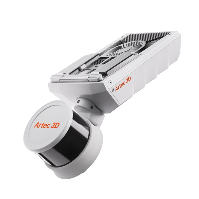
Artec Jet
- Best for
- Flown into stopes, shafts, ore passes and old workings, or over pits and dumps
- Type
- Multi-modal SLAM LiDAR
- Accuracy, up to
- ±10 mm underground, ±15 mm general
- Change detection
- ±5 mm
- Range
- 0.5–300 m
- Positional drift
- ±0.03%
- Deployment
- Handheld, backpack, pole, drone, vehicle, cage, robot
At 1.57 kg, IP65 and with no dependence on GPS or light, Jet is the scanner built to be flown. Its SLAM positioning is what lets the drone navigate underground, its 360° × 290° field of view records the whole cavity in a pass, and ±10 mm underground or ±15 mm on surface is what comes back. Sixteen hours of onboard storage cover a day of flights.
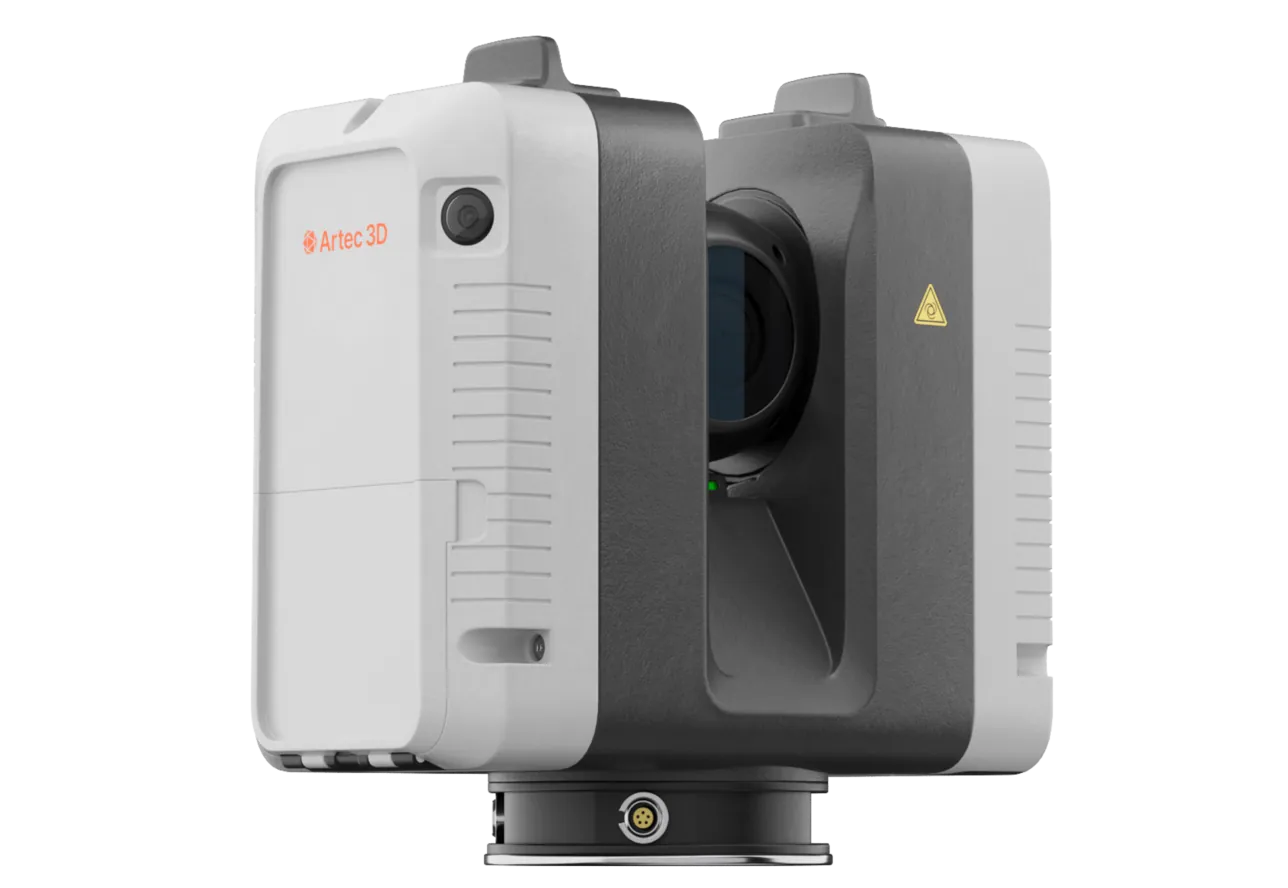
Artec Ray II
- Best for
- The launch area and any wall the flight covers that needs a signed-off figure
- Type
- Stationary long-range laser, tripod mounted
- Accuracy, up to
- 1.9 mm at 10 m, 2.9 mm at 20 m, 5.3 mm at 40 m
- Range noise
- 0.4 mm at 10 m
- Range
- 0.5–130 m
- Scan time
- 1 min 42 s at 3 mm, 10 m, without texture
- Field of view
- 360° × 300°
Where a face the drone flies over also carries a figure that has to be survey-grade — a highwall under review, an invoiced dump — Ray II on a tripod records it at 5.3 mm at 40 m from the rim, and the flown Jet capture registers into it. The drone covers the area; the tripod anchors it.
See a stope flown from the drawpoint by a drone that plans its own path, and reconciled against design the same shift — book a demo for your survey and planning teams.
Book a demoQuestions surveyors ask
Does the pilot need line of sight?
No. Underground the drone flies by SLAM against the geometry it is scanning and plans its own path; the pilot launches and recovers from safe ground. That is what makes a stope or a shaft flyable at all.
What obstacles can it avoid?
Down to 2 mm wires — ventilation bag ties and blasting cable are the usual ones. The drone plans around what the scanner sees, in complete darkness.
How accurate is the result?
±10 mm underground and ±15 mm on surface on the recorded surface, with ±0.03% positional drift held by SLAM and the flight tied to control at the launch point. Repeat flights compare at ±5 mm.
Can the same scanner be used off the drone?
Yes. Jet is the same device handheld, on a pole, on a vehicle or in a cage; the drone is one of its mounts. Most mines fly it where they must and carry it everywhere else.
Related applications
Tell us what you would fly into
Describe the openings or areas, what access exists and how they are measured today. A mining specialist will come back with whether a flight fits, what it would return and how it is tied to mine grid.