
Fall-of-ground and mine incident mapping
After a fall of ground, two things have to happen and they pull against each other: the site must be recorded before it is disturbed, and nobody must go near it until it is made safe. Photographs from the exclusion line and a sketch are what the investigation usually gets.
A scanner sent past the line — flown, on a pole or carried to the edge — records the failure, the debris and the surviving support at ±10 mm as found, and the investigation and the re-entry plan both work from a measured site.
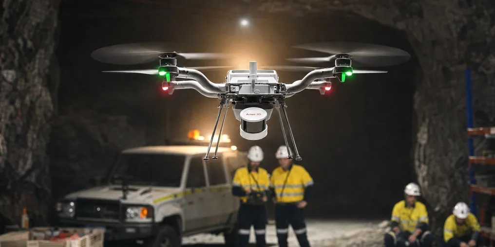
How is a fall of ground recorded without entering the site?
A SLAM LiDAR scanner is flown or extended past the exclusion line and records failure, debris and support as found at ±10 mm — with nobody under the back.
 From the exclusion lineFlown, pole-mounted or carried to the edge; nobody enters the site.
 As foundThe failure recorded before rehabilitation changes it.
 The failure measuredFall volume, unravelled height and debris extent as numbers, not estimates.
 Against the last surveyThe pre-incident as-built overlaid shows exactly what came down.
Why the incident record is usually a photograph
When ground falls, the exclusion zone goes up and the site becomes the one place on the mine nobody can go. The investigation — internal, regulatory, sometimes legal — needs to know the geometry of the failure, what support was in place and how it performed, and what the debris shows about the mechanism. What it typically gets is photographs taken from the exclusion line, a sketch and the last survey pick-up of that section, which may be weeks old. Rehabilitation then changes the site, and what was not recorded is gone.
The re-entry plan has the same problem. It has to be designed against the geometry that exists now — the unravelled height, the extent of the loose, the condition of the support at the edges of the fall — and that geometry is estimated from outside. A plan built on an estimate is either conservative, and slow, or optimistic, and dangerous.
A scanner sent into the exclusion zone records the site as found. Artec Jet on a drone plans its own path over the debris and under the broken back, or is extended on a pole from the line, and records the failure at ±10 mm with its own light and no GPS. Overlaid on the pre-incident as-built in Artec Twins, it shows exactly what came down and where; on its own it gives the re-entry plan a measured geometry and the investigation a dated record that rehabilitation cannot alter.
From exclusion line to measured site
Nobody crosses the line at any step.
 1. Deploy from the lineJet on a self-navigating drone, or on a pole extended past the exclusion boundary.
 2. Record as foundFailure surface, debris, surviving support and the drive around them at up to 1.9 million points per second.
 3. RegisterTwins ties the capture to survey control outside the zone and to the last pick-up of the section.
- 4. Compare with beforeThe pre-incident as-built overlaid; the fall volume, unravelled height and what came down are measured.
 5. Hand overOne dataset to the investigation, the geotechnical team and the re-entry planners — the same measured site for all three.
Which scanner for this work
The site cannot be entered and cannot be lit; the device has to be sent in.
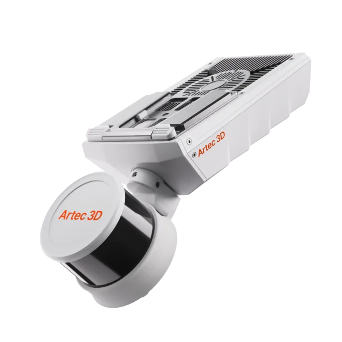
Artec Jet
- Best for
- The incident site as found, flown or extended past the exclusion line
- Type
- Multi-modal SLAM LiDAR
- Accuracy, up to
- ±10 mm underground, ±15 mm general
- Change detection
- ±5 mm
- Range
- 0.5–300 m
- Positional drift
- ±0.03%
- Deployment
- Handheld, backpack, pole, drone, vehicle, cage, robot
Jet goes into the exclusion zone so nobody else has to: on a drone it plans its own route over debris and avoids obstacles as fine as hanging 2 mm wires; on a pole it reaches past the line. With its own light, no GPS, IP65 sealing and ±10 mm accuracy, it returns the failure geometry, the debris and the support condition as a measured surface.
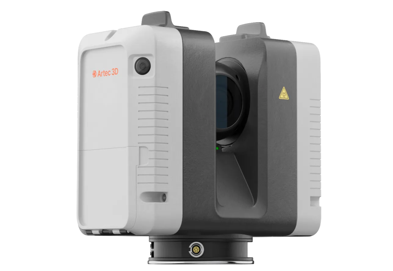
Artec Ray II
- Best for
- The failure from the exclusion line at survey-grade, out to 130 m
- Type
- Stationary long-range laser, tripod mounted
- Accuracy, up to
- 1.9 mm at 10 m, 2.9 mm at 20 m, 5.3 mm at 40 m
- Range noise
- 0.4 mm at 10 m
- Range
- 0.5–130 m
- Scan time
- 1 min 42 s at 3 mm, 10 m, without texture
- Field of view
- 360° × 300°
Where the site is in line of sight from the exclusion line, Ray II on a tripod records the failure surface and the debris from there at 1.9 mm at 10 m and out to 130 m, in under two minutes — a survey-grade record taken before anything is sent in, and the frame the Jet capture registers to.
See a fall of ground recorded as found from outside the exclusion zone, with the volume and the pre-incident overlay ready for the investigation — book a demo for your safety and geotechnical teams.
Book a demoQuestions safety and geotechnical teams ask
Is the scan acceptable to the investigation and the regulator?
It is a dated, complete, measured record of the site before it was disturbed, which is what an investigation lacks most. What a regulator requires is the regulator’s decision; the scan gives every party the same geometry to work from.
What if there is no pre-incident scan to compare with?
The as-found scan still gives the failure geometry, the debris volume and the support condition as measurements. If the section was picked up conventionally, the design profile or the survey wireframe is the comparison.
Can the drone fly a site with dust and broken services?
LiDAR is unaffected by darkness, and the drone plans around obstacles as fine as 2 mm wires — broken mesh, hanging cable and services are what it is designed to avoid. Heavy airborne dust degrades any optical method; the scan is taken once it has settled.
How does it help the re-entry plan?
The plan is designed against the actual unravelled height, the extent of loose and the condition of support at the edges, all measured at ±10 mm, rather than against an estimate from the exclusion line. Rehabilitation progress is then tracked by re-scanning.
Related applications
Tell us about your incident response
Describe how an incident site is recorded today and what the investigation and re-entry planning need from it. A mining specialist will come back with how the scanner is deployed from the line and what the record contains.