
Underground tunnel, drift and heading surveying
The heading survey is the one job that runs every cycle and holds up every cycle. The face cannot be marked up, the profile cannot be checked and the advance cannot be booked until the surveyor has been, set up and shot the round.
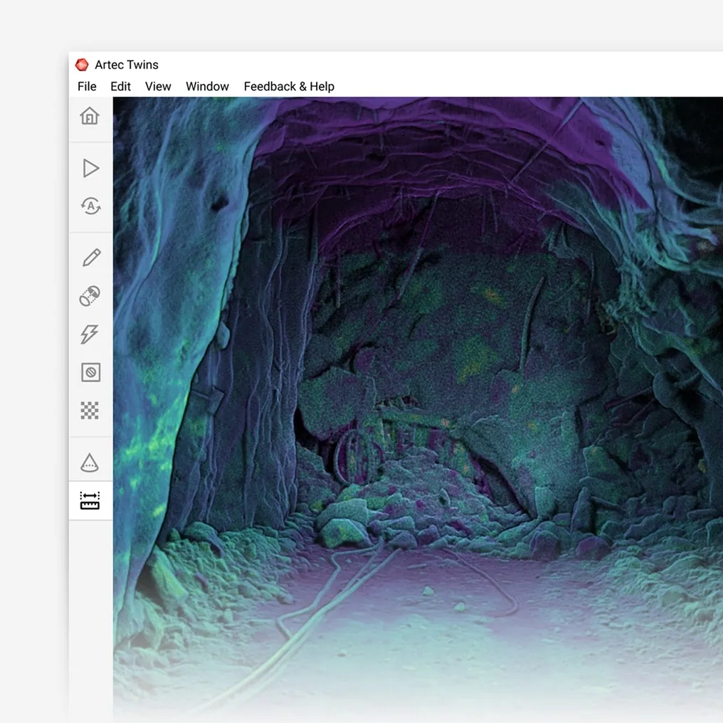
Walked with a SLAM scanner, the same heading is recorded in full — floor, walls and back — at the pace of the walk, with no instrument set-up and nothing for the crew to wait on.
How fast can a heading be surveyed with a 3D scanner?
At walking pace: a SLAM LiDAR scanner records the full profile of a drift at ±10 mm as the operator walks it, with no set-up, no orientation and no GPS.
 Walking paceNo stations, no levelling, no backsight; the survey takes as long as the walk.
 The whole profileFloor, walls and back at every metre, not a dozen shots per round.
 ±0.03% driftPosition held from the rock, tied to control where control exists.
 Booked the same shiftAdvance, profile and as-built into the planning package before the next round.
Why the heading waits for the surveyor
A conventional pick-up is a sequence: carry the instrument to the last station, set up, level, orient, shoot the face and the profile, move up, repeat. Each set-up costs minutes and the round costs several of them, and the mining crew stands down while it happens because the face cannot be marked until the survey is in. Across a development fleet, the hours a heading spends waiting for survey are a real fraction of the cycle.
What comes out is also thin. A round is described by the shots the surveyor took — a centreline, a few profile points, the face position. The as-built that accumulates from years of this is a wireframe of chosen points, and a question later about a section of drive — its true profile, where a pipe run will clear, whether the back has changed — sends someone back with the instrument.
A SLAM LiDAR scanner records the drift while the operator walks it. Artec Jet holds ±0.03% positional drift with no set-up and no GPS, tying to survey control wherever a station is passed, and records the full profile at ±10 mm — up to 1.9 million points per second across a 360° × 290° field of view. The heading is picked up in the time it takes to walk to the face and back, and the as-built is the complete surface, exported as LAS, LAZ or E57 into Vulcan, Deswik or Surpac the same shift.
One walk, the round booked
The survey is finished when the walk is.
 1. Start on controlBegin the walk at a known station so the capture carries mine grid from the first metre.
- 2. Walk the headingHandheld or backpack-mounted, Jet records floor, walls and back to the face at walking pace, in whatever light there is.
 3. RegisterArtec Twins ties the capture to the stations passed and the previous pick-up.
- 4. Section and checkProfile at every metre against design; face position and advance for the round.
- 5. Book itAdvance, profile and the growing as-built into the planning package as LAS, LAZ or E57.
Which scanner for this work
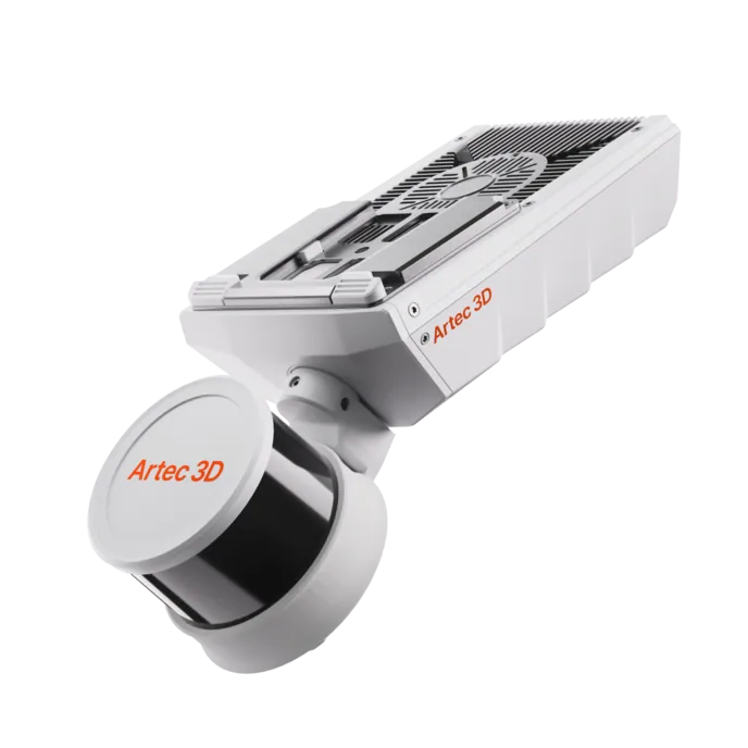
A heading is walked, so the device is the one that surveys while walking.
Artec Jet
- Best for
- Every heading, drift and decline — walked or on a vehicle
- Type
- Multi-modal SLAM LiDAR
- Accuracy, up to
- ±10 mm underground, ±15 mm general
- Change detection
- ±5 mm
- Range
- 0.5–300 m
- Positional drift
- ±0.03%
- Deployment
- Handheld, backpack, pole, drone, vehicle, cage, robot
Jet is a SLAM LiDAR scanner at 1.57 kg that records the whole drift as it is carried through it, with no set-up between the collar and the face. ±0.03% drift keeps the pick-up true between stations, ±10 mm accuracy covers profile and advance, and 16 hours of onboard capture cover a full shift of headings. On a vehicle it picks up the decline on the way down.
Artec Ray II
- Best for
- Excavations that need survey-grade profile: portals, stations, chambers, tie-in points
- Type
- Stationary long-range laser, tripod mounted
- Accuracy, up to
- 1.9 mm at 10 m, 2.9 mm at 20 m, 5.3 mm at 40 m
- Range noise
- 0.4 mm at 10 m
- Range
- 0.5–130 m
- Scan time
- 1 min 42 s at 3 mm, 10 m, without texture
- Field of view
- 360° × 300°
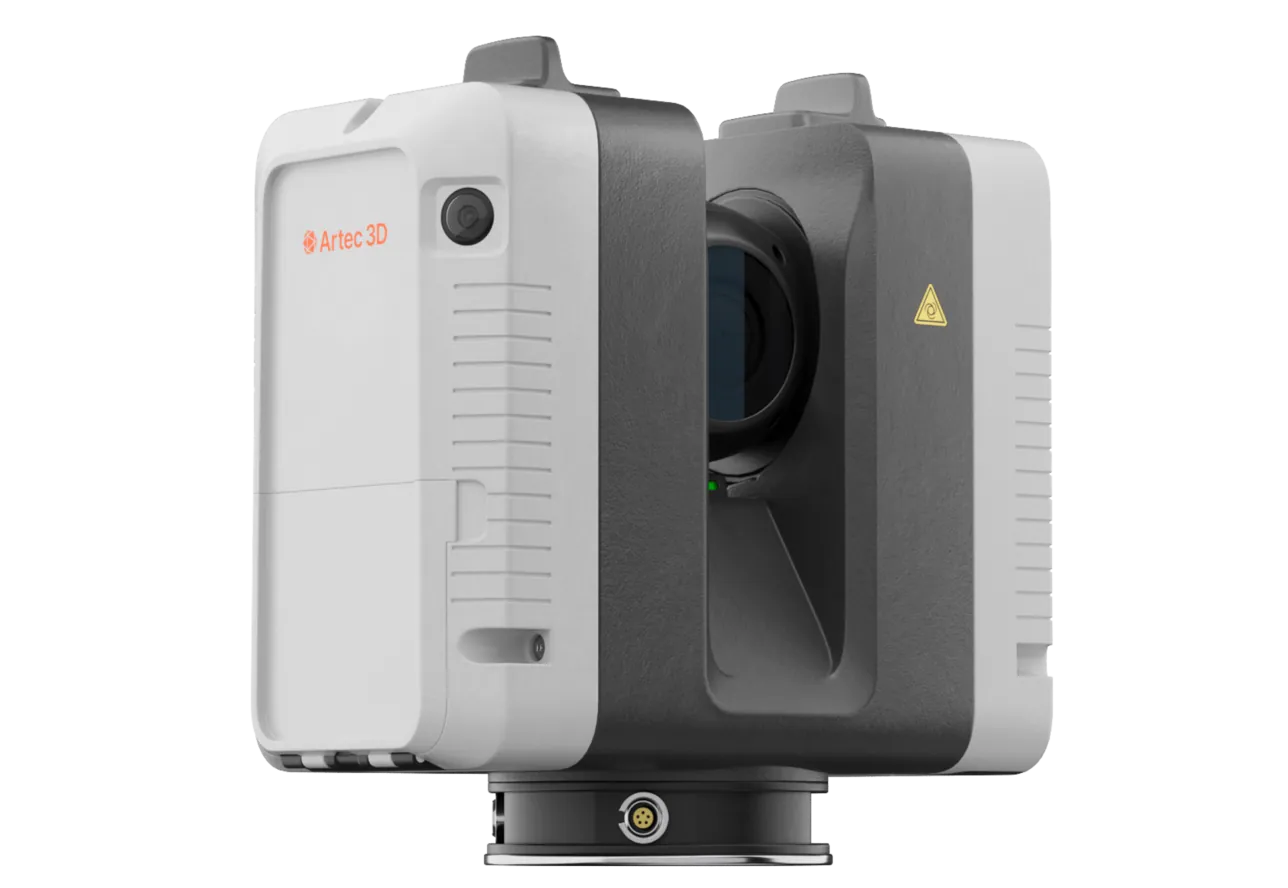
Where an excavation has to be right to the millimetre — a crusher chamber, a shaft station, a portal, the tie-in for a conveyor — Ray II on a tripod records it at 1.9 mm at 10 m in under two minutes per station, and the walked Jet survey registers into it.
See a heading picked up floor to back in the time it takes to walk to the face — book a demo for your development survey crew.
Book a demoQuestions development surveyors ask
How does it stay on mine grid without set-ups?
SLAM holds ±0.03% positional drift from the rock geometry, and the capture ties to survey control wherever a station is passed. A drive between two stations is held by both; control is used, not replaced.
Is ±10 mm accurate enough for a heading survey?
For profile against design, face position and advance, yes — and it applies to the whole surface rather than to a dozen shots. Where a specific point needs survey-grade accuracy, that point is still shot; the scan gives everything around it.
Can it be run from a vehicle?
Yes. Jet mounts to a vehicle as well as being carried, so a decline or a long haulage drive is picked up on the way through without stopping.
What does the mining crew see?
A profile and a face position before the next round, instead of a wait. The scan finishes with the walk, and the section against design is available as soon as the capture is registered.
Related applications
Tell us about your development headings
Describe the number of headings, the cycle and how the pick-up runs today. A mining specialist will come back with what a walked survey would change in the cycle and how the as-built lands in your package.