
Inaccessible and abandoned mine workings mapping
Every old mine has workings nobody has entered in years: a sealed level, a stope from a previous operator, a drive on a plan that was drawn by hand and may not be where the plan says. Current mining has to keep a stand-off from all of it, and the stand-off is only as good as the plan.
A scanner flown or carried into the old workings records what is actually there, at ±10 mm, and the historical plan is replaced by a survey.
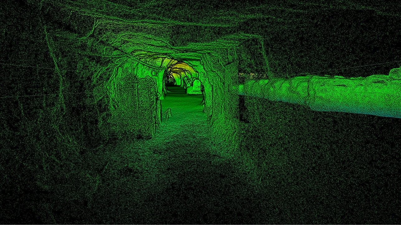
How do you map old workings that cannot be entered?
Send in the scanner instead of a person: on a drone, pole or cage it records the workings at ±10 mm without GPS or light, replacing the historic plan.
 Flown inA drone that plans its own path through workings nobody has seen.
 No survey control needed insideSLAM holds position from the rock; the capture is tied to grid at the entry point.
 Plan replaced by surveyThe historic drawing becomes a measured model in the current mine plan.
 Stand-offs you can defendPillar and barrier distances measured to the actual old excavation.
Why the old plan is the risk
Historic workings are known from records: hand-drawn plans, survey books, sometimes only a note that a level existed. Those records were accurate to the standards of their time and have been copied, redrawn and re-projected since. Modern development that has to keep a distance from them keeps that distance from a drawing, and the drawing can be wrong by metres. A crosscut that breaks into an old stope, or a barrier pillar that turns out to be thinner than the plan implied, is the failure mode this produces.
Entering old workings to survey them is often not an option. The ground has not been scaled or supported for decades, the ventilation is unknown, and the access itself may be the hazard. So the choice has been to work from the old plan with a generous margin — sterilising ore behind that margin — or to send people into ground nobody can vouch for.
A scanner that goes in instead removes the choice. Artec Jet on a drone plans its own flight path through workings nobody has mapped, avoiding obstacles as fine as 2 mm wires, with its own light and no GPS, holding ±0.03% positional drift. On a pole or in a cage it reaches what a drone cannot. The capture is tied to mine grid at the entry, and the old level exists as a measured surface at ±10 mm — the plan replaced by a survey, and every stand-off measured to the real excavation.
From historic plan to measured model
Nobody enters the old workings at any step.
- 1. Establish the entryA breach, a raise or an opened seal, with survey control on the current side of it.
- 2. Send the scanner inJet on a self-navigating drone, or on a pole or cage where the opening is too small to fly.
 3. Capture the workingsDrives, stopes and voids recorded at up to 1.9 million points per second in complete darkness.
 4. Tie to mine gridTwins registers the capture to the control at the entry, so the old workings sit in today’s coordinate system.
 5. Replace the planThe measured model into Vulcan, Deswik or Surpac; stand-offs and pillars redesigned to the real excavation.
Which scanner for this work
Unknown ground, no light, no signal, no entry: one device is built for this.
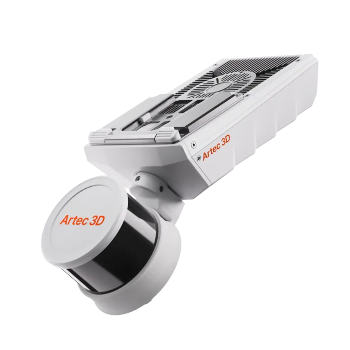
Artec Jet
- Best for
- The old workings themselves, flown, carried or lowered in
- Type
- Multi-modal SLAM LiDAR
- Accuracy, up to
- ±10 mm underground, ±15 mm general
- Change detection
- ±5 mm
- Range
- 0.5–300 m
- Positional drift
- ±0.03%
- Deployment
- Handheld, backpack, pole, drone, vehicle, cage, robot
Jet is the scanner that goes into ground nobody can vouch for. On a drone it plans its own path through unmapped drives and avoids obstacles as fine as 2 mm wires; on a pole or in a cage it reaches what a drone cannot. With no GPS, its own light, IP65 sealing and 16 hours of onboard capture, it returns the old level as a measured surface at ±10 mm.
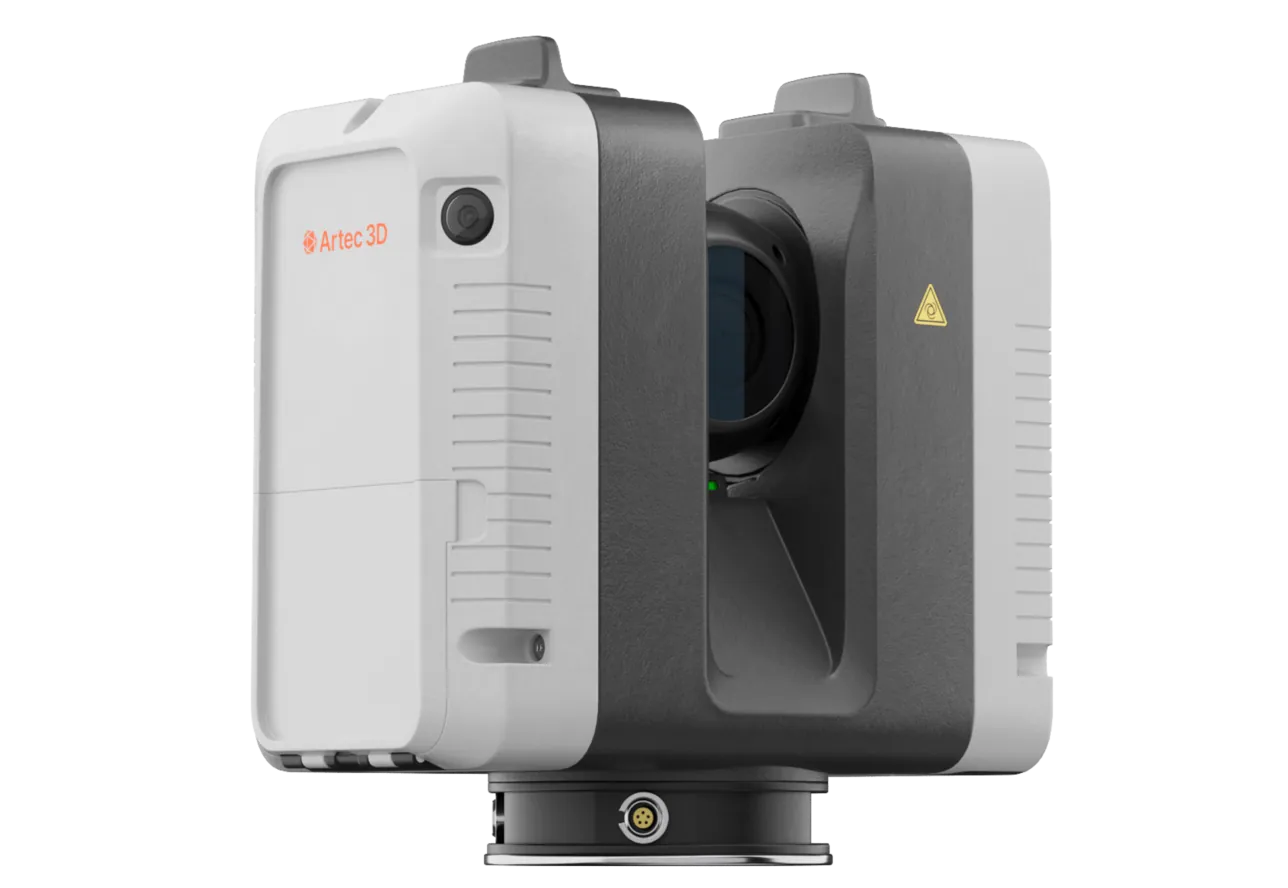
Artec Ray II
- Best for
- The entry and everything in line of sight from it, at survey-grade
- Type
- Stationary long-range laser, tripod mounted
- Accuracy, up to
- 1.9 mm at 10 m, 2.9 mm at 20 m, 5.3 mm at 40 m
- Range noise
- 0.4 mm at 10 m
- Range
- 0.5–130 m
- Scan time
- 1 min 42 s at 3 mm, 10 m, without texture
- Field of view
- 360° × 300°
Before anything is sent in, Ray II on a tripod at the breach or the opened seal records what is visible from the current side at 1.9 mm at 10 m and ties it to survey control. That fixes the entry in mine grid, which is what the Jet capture of the workings beyond registers to.
See a sealed level mapped by a drone and dropped into your current mine plan as a measured model — book a demo for your planning and geotechnical teams.
Book a demoQuestions surveyors ask
How does the scanner navigate workings nobody has mapped?
SLAM — it builds its own map as it moves and positions itself against it, holding ±0.03% drift, and on a drone it plans its own flight path around what it finds, including obstacles as fine as 2 mm wires. No prior plan and no signal from outside are needed.
How is the capture tied to today’s mine grid?
Through survey control on the current side of the entry. The scan begins in known coordinates and carries them into the old workings; Artec Twins registers the whole capture to that control, so the historic level sits in the modern coordinate system.
What if the drone cannot fly the opening?
The same scanner goes in on a pole or is lowered in a cage. Jet is 1.57 kg, and its 360° × 290° field of view records everything around it whichever way it is carried.
Can we then reduce the stand-off from the old workings?
That is a geotechnical decision, but it is made against a measured excavation rather than a redrawn plan. Pillar and barrier thicknesses are known to ±10 mm instead of to the uncertainty of a historic survey.
Related applications
Tell us about the workings you need to map
Describe what is known about the old workings, what access exists and what current development has to keep clear of them. A mining specialist will come back with the deployment and what the model would resolve.